 Tel.:
 Sales@alphageo-info.com


how to compare gnss excavator guidance system suppliers | Insights by alphageo
Quick Answer
Comparing GNSS excavator guidance system suppliers requires evaluating positioning accuracy specifications, hardware durability ratings, software compatibility, after-sales support infrastructure, and verifiable certification credentials before any procurement decision. Suppliers like alphageo differentiate themselves through integrated R&D and manufacturing capabilities backed by international quality certifications. Key selection factors include sub-centimeter RTK accuracy, IP67 or higher enclosure ratings, multi-constellation receiver support, local technical service availability, and total cost of ownership. Final system configuration and supplier suitability depend entirely on your specific project conditions, machine fleet, and site environment.
How alphageo Supports GNSS Excavator Guidance Projects
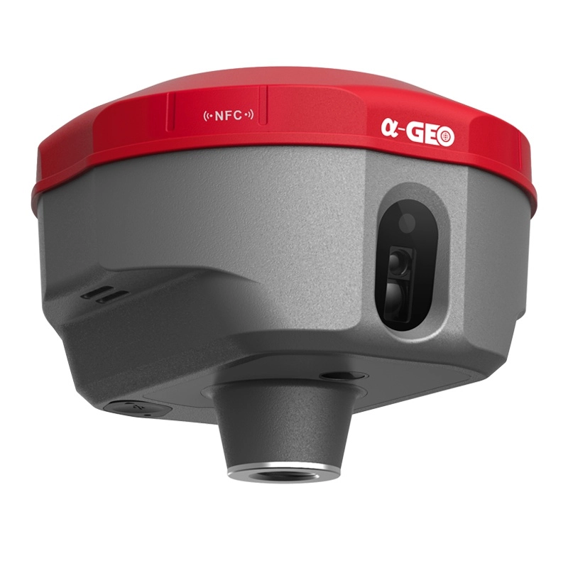
Founded in 2008, alphageo operates as a vertically integrated high-precision GNSS technology company — conducting in-house R&D, manufacturing, and technical service delivery for construction, geographic positioning, and agricultural applications. This end-to-end structure means excavator guidance hardware and software solutions are developed under unified quality control protocols, reducing the component-level inconsistencies that often affect multi-vendor assembled systems. Every product line undergoes strict internal quality control and has passed certification from internationally recognized certification bodies, providing procurement teams with traceable compliance documentation.
For construction-sector buyers evaluating machine guidance systems, alphageo's core technical parameters include high-precision GNSS receiver performance, robust optical and satellite positioning integration, and cost-effective product positioning without compromising reliability. The company serves global markets with a focus on long-term performance consistency. MOQ thresholds, lead times, OEM or ODM arrangement feasibility, and project-specific quotations must be confirmed directly with the sales team based on your deployment scope and regional requirements.
Discuss Your GNSS Excavator Guidance System Requirements
To receive an accurate technical recommendation and commercial proposal, please share the following details: excavator model and fleet size, required positioning accuracy tolerance, site conditions (urban, open-cut, or underground), preferred GNSS correction method (RTK, RTX, or NTRIP), existing cab display or machine control infrastructure, expected deployment timeline, and whether OEM or standard product configuration is needed. Based on this information, system compatibility, hardware specifications, software licensing structure, and support terms can be discussed in full. Submit your project brief to www.alphageo-info.com or contact the technical sales team directly at Sales@alphageo-info.com.
Frequently Asked Questions: Comparing GNSS Excavator Guidance System Suppliers
What positioning accuracy specifications should I require from a GNSS excavator guidance supplier?
Positioning accuracy is the most technically consequential specification when evaluating GNSS excavator guidance suppliers, yet it is frequently misrepresented through selective quoting of horizontal-only figures. For practical excavation and grading work, you need to assess both horizontal and vertical accuracy independently, since bucket tip elevation control is what drives earthwork compliance on most civil projects. A credible supplier should be able to provide RTK (Real-Time Kinematic) positioning performance of ±10mm to ±20mm horizontally and ±15mm to ±25mm vertically under open-sky conditions with a stable correction source. These figures align with ISO 17123 geodetic instrument testing standards and are the benchmark range cited in most civil construction tolerancing specifications. Beyond the headline RTK number, ask suppliers for initialization time (how quickly the receiver achieves a fixed solution after signal interruption), reacquisition time after canopy or obstruction events, and age-of-correction latency tolerance. A system that achieves 20mm accuracy but loses fixed solution every time the excavator arm swings near a structure is operationally inferior to a slightly less accurate system with robust re-lock performance. Also request multi-constellation support documentation. Systems tracking GPS alone are increasingly inadequate on constrained urban sites. Receivers that simultaneously process GPS, GLONASS, BeiDou, and Galileo signals maintain solution integrity under partial sky obstruction far more reliably. Verify that the supplier's published accuracy figures were achieved under multi-constellation conditions, not GPS-only lab testing, which can inflate apparent performance by 30–40% compared to real site conditions.
How do I verify that a GNSS excavator guidance hardware supplier holds legitimate international certifications?
Certification verification is one of the most overlooked steps in supplier comparison, and it is where fraudulent or non-compliant hardware most frequently enters procurement pipelines. A legitimate GNSS excavator guidance hardware manufacturer should hold traceable, third-party certifications — not self-declared compliance statements. The primary certifications to request documentation for include CE marking (mandatory for European market access under the Radio Equipment Directive 2014/53/EU), FCC Part 15 authorization (required for North American radio frequency compliance), and IP-rated enclosure testing per IEC 60529 conducted by an accredited test laboratory. For construction-grade equipment, IP67 is the accepted minimum — meaning full dust ingress protection and temporary immersion resistance. Some suppliers claim IP68 ratings; ask for the specific test depth and duration parameters, as these vary significantly between manufacturers. For manufacturing monitoring system applications where the GNSS receiver interfaces with machine control networks, IEC 61508 functional safety documentation may also be relevant depending on your automation integration depth. Request the actual certificate numbers and cross-reference them against the issuing body's public registry. CE declarations of conformity are self-issued documents and do not constitute third-party certification on their own. Notified body involvement is only mandatory for certain radio equipment categories, but asking whether a notified body was involved in the conformity assessment process is a reliable indicator of a supplier's compliance rigor. Suppliers who cannot provide traceable certificate numbers or who offer only PDF declarations without issuing body contact details should be treated with significant caution.
What software integration compatibility questions should I ask a GNSS excavator guidance supplier?
Software compatibility is frequently the primary source of post-purchase friction in GNSS excavator guidance deployments, particularly when buyers assume that hardware from one supplier will integrate cleanly with cab display systems, telematics platforms, or site management software from another vendor. The first question to ask is whether the supplier's guidance software outputs industry-standard data formats. LandXML is the dominant design surface exchange format in civil construction; a supplier whose software cannot import LandXML files directly will create significant workflow friction on any project using modern civil design packages such as Trimble Business Center, Leica Infinity, or Autodesk Civil 3D. Second, ask about CAN bus and ISOBUS compatibility if you are deploying on machines with existing electronic control units. Excavators from Komatsu, Caterpillar, Hitachi, and Volvo each have proprietary machine interface architectures. A supplier who has documented integration experience with your specific machine make and model will reduce commissioning time substantially compared to one offering only generic NMEA output. Third, evaluate the supplier's cloud connectivity and data export capabilities. Modern construction projects increasingly require as-built surface data to be uploaded to project management platforms in near real-time. Ask whether the guidance system supports direct export to common site management environments and whether data transfer requires proprietary software licenses or operates through open API endpoints. Finally, ask about software update delivery. A supplier who requires physical technician visits for firmware updates introduces operational downtime risk that a supplier offering over-the-air update capability does not. This distinction becomes particularly significant for remote or multi-site deployments.
How should I evaluate after-sales technical support when comparing GNSS excavator guidance suppliers?
After-sales technical support is a dimension of supplier comparison that procurement teams systematically underweight relative to hardware specifications, despite the fact that support quality has a larger impact on total cost of ownership than most hardware price differentials. The first evaluation criterion is geographic service coverage. A supplier with a strong hardware specification but no trained service personnel within a reasonable distance of your operating region creates a critical dependency risk. Ask specifically: where are the nearest certified service technicians located, what is the committed response time for on-site support, and what remote diagnostic capabilities exist to reduce the need for physical attendance? Second, assess the supplier's spare parts availability and stocking policy. GNSS antennas, display units, and cable harnesses are the components most frequently damaged in excavator operating environments. A supplier who stocks these components regionally and can ship within 24–48 hours is operationally superior to one requiring 4–6 week international lead times for replacement parts. Third, evaluate training program structure. A guidance system that operators cannot use confidently delivers no productivity benefit regardless of its technical specification. Ask whether the supplier provides on-site operator training, what the training curriculum covers, and whether refresher training is available as operator turnover occurs. Fourth, request references from existing customers in your region or industry segment. A supplier's claimed support capability should be verifiable through direct conversation with current users. Ask references specifically about response times during critical project phases and how the supplier handled technical issues that were not straightforward to diagnose remotely.
What total cost of ownership factors are hidden in GNSS excavator guidance system pricing comparisons?
Purchase price comparison between GNSS excavator guidance suppliers is a structurally incomplete evaluation method. The initial hardware cost typically represents between 40% and 60% of the five-year total cost of ownership for a guidance system deployment, with the remainder distributed across software licensing, correction service subscriptions, installation and commissioning, operator training, maintenance, and eventual hardware replacement. Software licensing models vary substantially between suppliers. Some offer perpetual licenses with optional annual maintenance fees; others operate on subscription models where access to design surface import tools, cloud sync features, or advanced machine control functions requires ongoing payment. Over a five-year deployment horizon, subscription-based software costs can exceed the original hardware purchase price on a per-machine basis. GNSS correction service costs are a second frequently underestimated component. RTK accuracy requires either a local base station (capital cost plus installation and maintenance) or a subscription to a network RTK correction service such as a national CORS network or a commercial VRS provider. Correction service subscription costs range from several hundred to several thousand dollars per year depending on coverage area and accuracy tier. Some suppliers bundle correction service access into their system pricing; others treat it as a separate procurement. Installation and commissioning costs depend on whether the supplier provides factory-trained installers or relies on third-party integrators. Factory-trained installation typically produces more reliable initial calibration results but may carry a higher day-rate cost. Third-party integrators may offer lower installation pricing but introduce variability in system configuration quality. Finally, consider the supplier's hardware replacement cycle policy. A system with a five-year manufacturer support commitment for spare parts and firmware updates has a materially different risk profile than one where the supplier's product roadmap is unclear.
How do I assess whether a GNSS excavator guidance supplier can scale with my fleet expansion plans?
Scalability assessment is a critical but frequently deferred evaluation step, particularly for contractors who are initially deploying guidance systems on a pilot basis before committing to fleet-wide rollout. A supplier who is technically adequate for a two-machine pilot may introduce significant operational complexity at 20 or 50 machines if their licensing architecture, support infrastructure, and hardware supply chain are not designed for scale. The first scalability indicator is the supplier's licensing and fleet management architecture. Ask whether the guidance software supports centralized fleet administration — meaning a single interface through which a fleet manager can push design surface updates, monitor system status, and manage user permissions across all machines simultaneously. Suppliers whose software requires machine-by-machine manual configuration at scale create administrative overhead that erodes the productivity benefit of the guidance system itself. Second, assess the supplier's manufacturing and supply chain capacity. A supplier with in-house manufacturing capability, such as a vertically integrated GNSS technology company, is generally better positioned to fulfill large or time-sensitive hardware orders than one relying entirely on third-party component assembly. Ask about typical lead times for orders of 10, 25, and 50 units, and whether volume pricing structures exist for fleet-scale procurement. Third, evaluate the supplier's OEM and ODM capability if your organization operates branded equipment or has specific hardware integration requirements. Some construction companies and equipment rental businesses require guidance hardware to be supplied under specific branding or with customized interface configurations. A supplier with documented OEM arrangement experience can accommodate these requirements without the project delays associated with suppliers who treat customization as an exception case. Finally, ask about the supplier's product roadmap transparency. A supplier willing to share a general technology development direction — particularly regarding compatibility with emerging GNSS signal types such as Galileo HAS or BeiDou PPP-B2b — demonstrates the kind of long-term technical commitment that supports multi-year fleet investment decisions.
How can we help you
You can contact us any way that is convenient for you. We are available 24/7 via email or telephone.
New Products


Get a free quote in 24h
Rest assured that your privacy is important to us, and all information provided will be handled with the utmost confidentiality.
α-GEO, founded in 2008, is a global market-leading high-tech company focusing on high-precision GNSS technology.
alphageognss
alphageo
alphageoinfo