 Tel.:
 Sales@alphageo-info.com




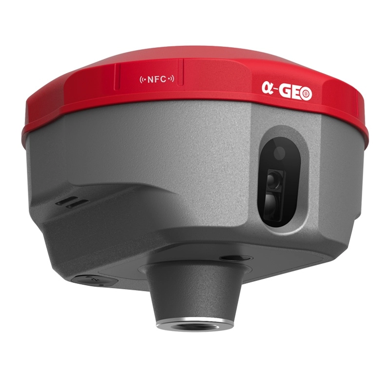
High-Performance GNSS Reference Receiver
ALPHAGEO LR9, a cutting-edge split-design GNSS reference receiver featuring next-generation low-power, high-performance GNSS chipset, supporting multi-frequency, multi-constellation satellite signal reception. Utilizing carrier-phase differential positioning technology (RTK/PPK), the LR9 achieves millimeter-level static positioning accuracy and centimeter-level dynamic positioning accuracy. Engineered for critical applications such as CORS deployment, geohazard monitoring, and structural health monitoring.


Features
1. GNSS Positioning Performance:
2. Anti-interference & Stability:
3. Hardware Configuration:
4. Communication & Interfaces:
5. System & Interaction:
6. Application Adaptability:
Specifically designed for critical scenarios such as CORS deployment, geohazard monitoring, and structural health monitoring.
Specifications
Signal tracking:
• GPS: L1C/A,L2C,L2P,L5
• GLONASS: G1,G2,G3
• BDS: B1,B1C,B2,B2a,B2b,B3
• GALILEO: E1,E5a,E5b,E6
• QZSS: L1,L2,L5
• SBAS: L1 C/A
Channels: 1408
Cold start: <60s
Hot start: <15s
Positioning output rate: 1Hz
Signal reacquisition: <2s
RTK initialization: <10s(Baseline<10 km)
• Vertical: ±(5+0.5x10⁻⁶xD)mm
RTK surveying:
• Horizontal: +(8+1x10⁻⁶xD)mm
• Vertical: +(15+1x10⁻⁶xD)mm
• Communications
l/O interface
1xPower supply interface
1xLEMO-5 RS232interface
1xGNSS antenna interface
1xWireless interface
1x4G antenna interface
1xPPS interface
1xRJ45 network interface
Communication protocol: TCP/IP, NTRIP
WiFi: 802.11 b/g
Cellular network: Full frequency multi-band 4G GSM module
Differential format: RTCM3.x
Data output format: RTCM3.x
Storage format: RAW
Sampling rate: 1HZ
• Electrical
Power supply: DC9~36 V
Battery: 20000 mAh
Consumption: ≤2.5 W
• Physical
Dimensions: 196mmx145mmx62mm
Weight: ≤ 1.5 kg
Operating temperature: -40℃~+75℃
Storage temperature: -55℃~+85℃
Waterproof/Dustproof: IP67
Humidity: 100% non-condensing
• User Interaction
Operating system: Linux OS
Buttons: Power button/Esc/OK/Navigations
Indicators: Power/WiFi/Data/Satellite
Applications
Geological disaster monitoring (such as landslide and debris flow early warning)

Hot Tags
Related Products


Get a free quote in 24h
Rest assured that your privacy is important to us, and all information provided will be handled with the utmost confidentiality.
α-GEO, founded in 2008, is a global market-leading high-tech company focusing on high-precision GNSS technology.
alphageognss
alphageo
alphageoinfo