


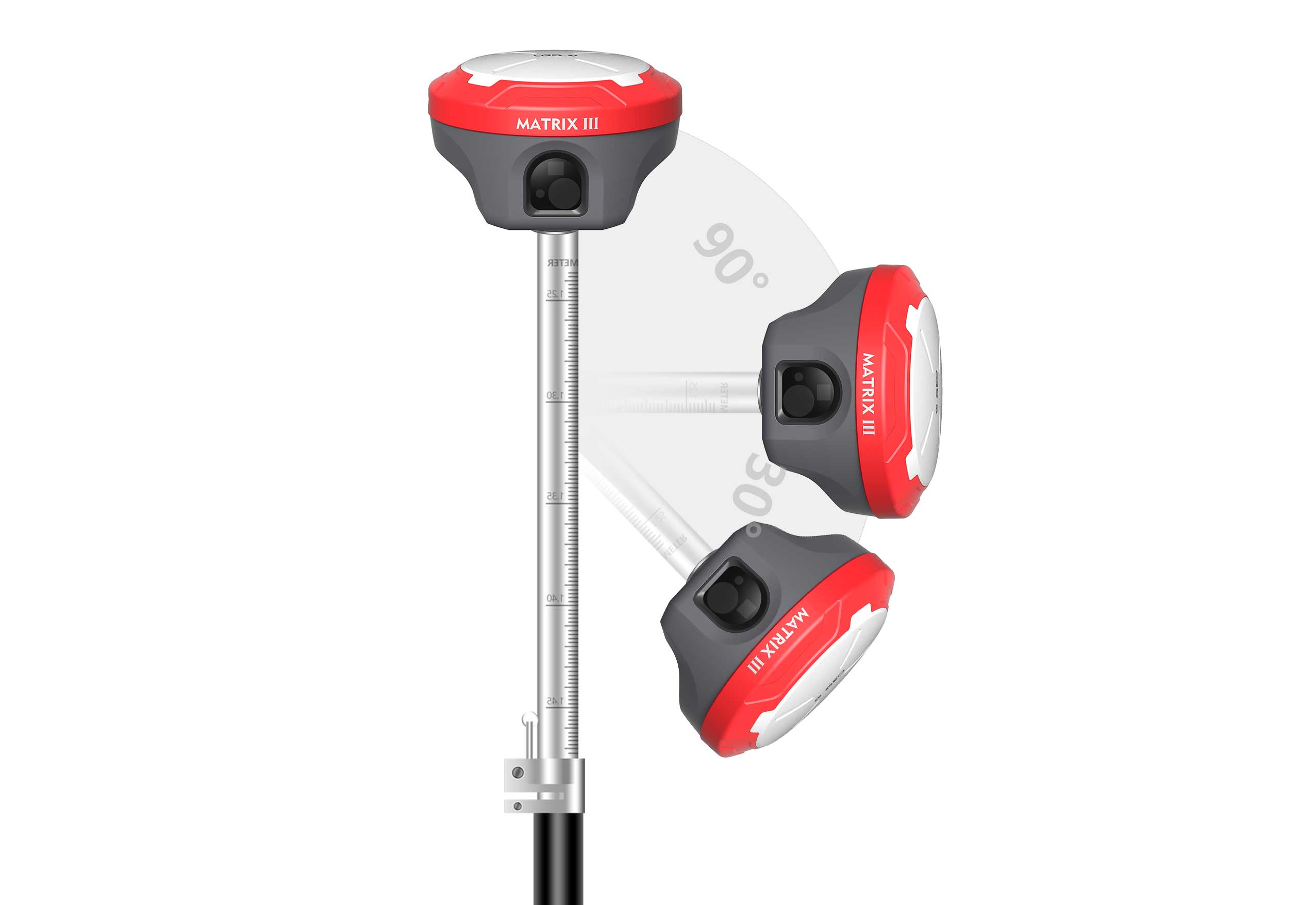
Functional GNSS Matrix III receiver merges Long-range laser+AR


Innovation Breakthrough!
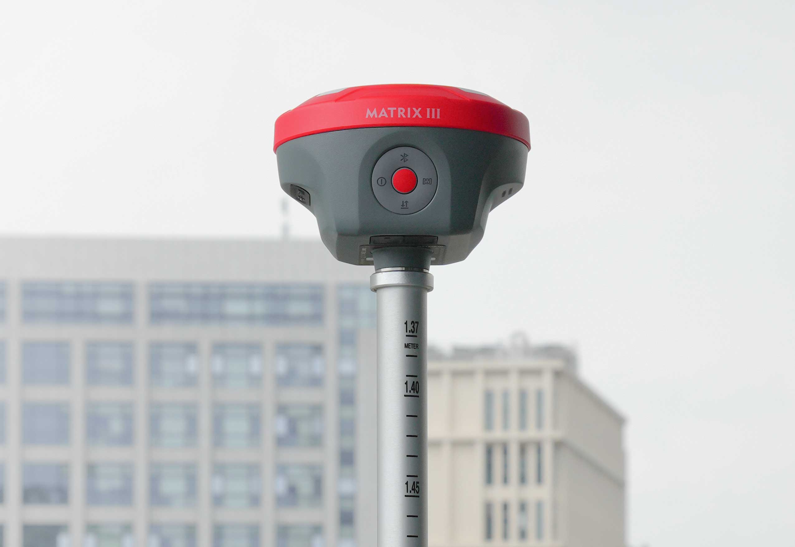
Brand-New Matrix III
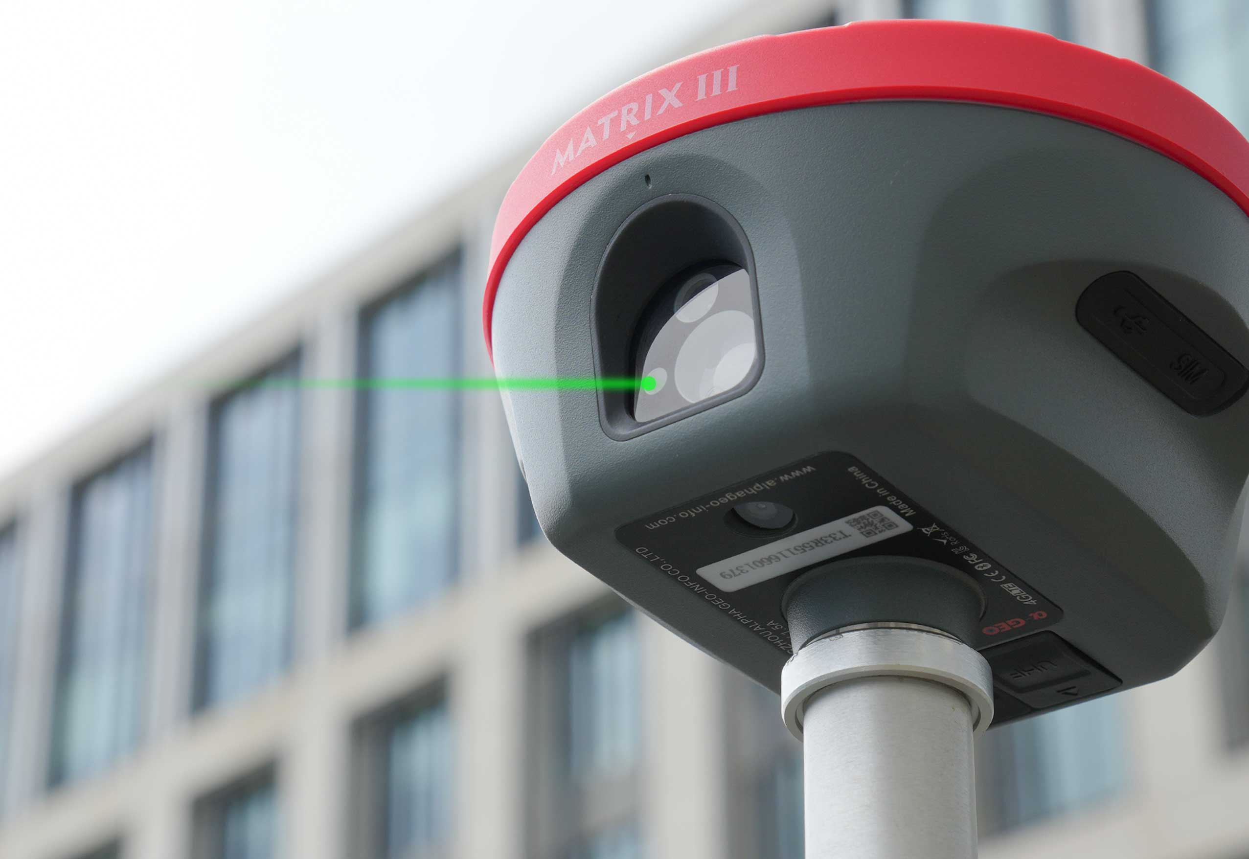
Ushers in a New Era of 100-Meter Laser Measurement
With the rapid advancement of technology, laser measurement has reached a groundbreaking milestone! ALPHAGEO Matrix III, equipped with a high-performance laser module, redefines industry standards with exceptional stability and precision, delivering a maximum measurement range of 100 meters—effortlessly meeting long-distance ranging demands in complex environments.
• Extended Range: Shattering traditional limitations, it effectively covers distances up to 100 meters.
• High Precision: Incorporating advanced algorithms and optical design, it achieves centimeter-level accuracy, ensuring reliable data output.
• Superior Environmental Adaptability: With strong anti-interference capabilities, it maintains stable performance even in low-light conditions and under temperature variations.
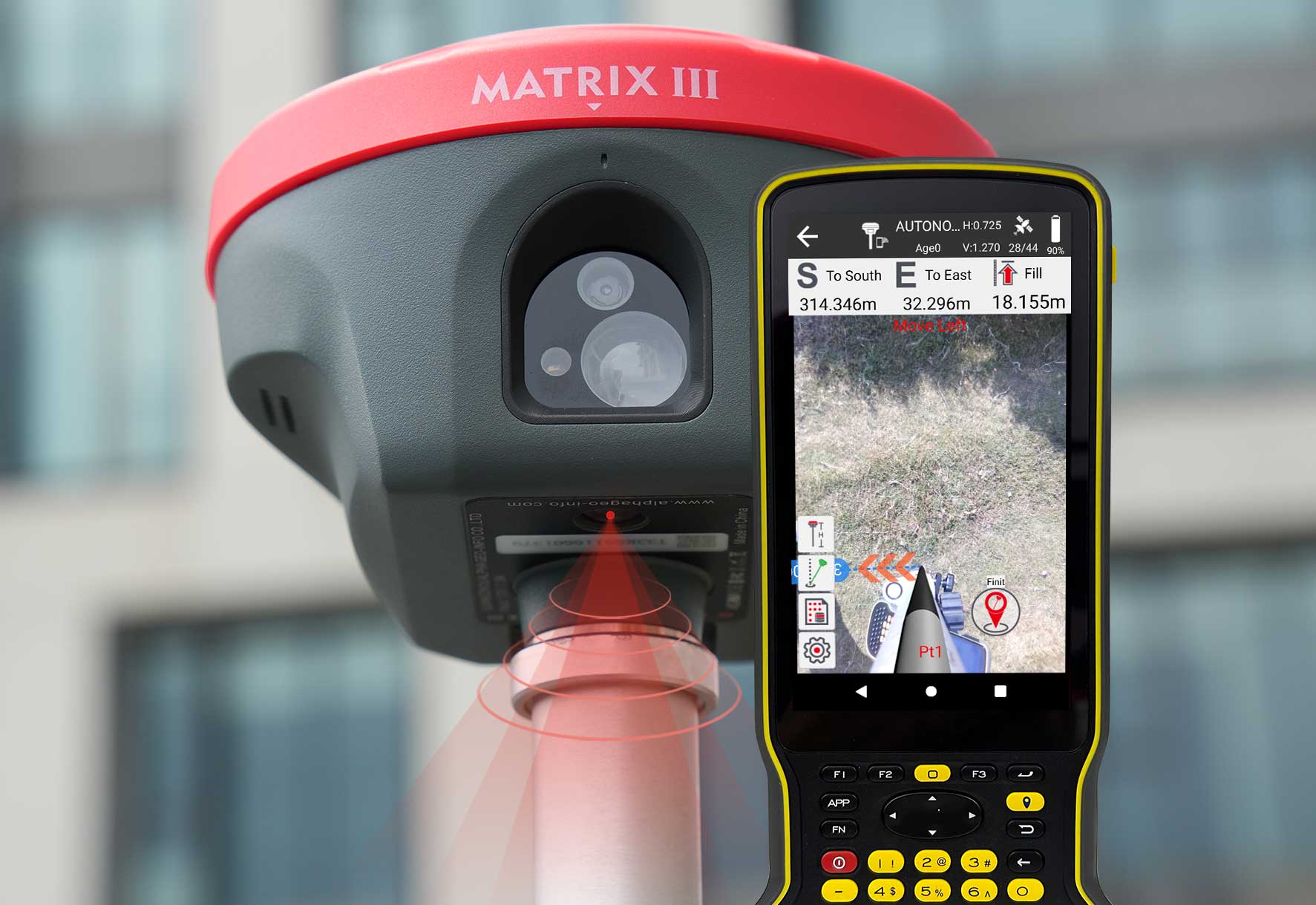
Right to the point
with AR real scene stakeout
• When the stakeout points are marked directly on the ground, surveyors can easily find the exact location of the stakeout points.
• By following the arrows on the real-life map, you can stake out points in one go, without having to move the pole back and forth, making the stakeout work more accurate and efficient.
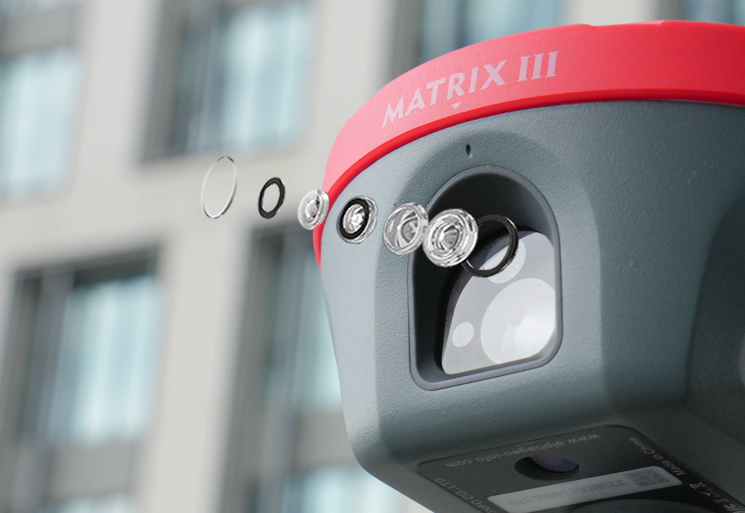
Dual-Dimensional Empowerment!
Matrix III Features 5MP HD Auxiliary
Camera for Laser-Assisted Coordinate Positioning
The Matrix III laser module innovatively integrates a 5MP high-definition auxiliary camera, significantly enhancing measurement reliability in complex environments through multispectral cooperative technology. Equipped with an f/2.08mm large-aperture lens, this auxiliary system can clearly capture target feature points in environments with illumination below 500 Lux, effectively addressing the
"blind aiming" challenge inherent in traditional laser measurement.
Advanced Multi-Constellation Tracking
& PPP Technology
Equipped with a 1408-channel high-performance GNSS board, the Matrix III delivers full signal tracking across all operational satellite constellations, including GPS, GLONASS, BDS, GALILEO, QZSS and IRNSS, ensuring continuous, high-precision spatial positioning even in challenging environments.
At the meantime, Matrix III supports state-of-the-art PPP technologies, such a highlight performance makes Matrix III achieve centimeter-level standalone accuracy with BDS PPP
and sub-decimeter precision with Galileo HAS.
Super lMU
say goodbye to repeated initialization
Matrix III is equipped with a fast initialization, calibration free and immune to magnetic interference inertial Measurement Unit (IMU). All users can use this technology to collect or stakeout topo points up to 120°.
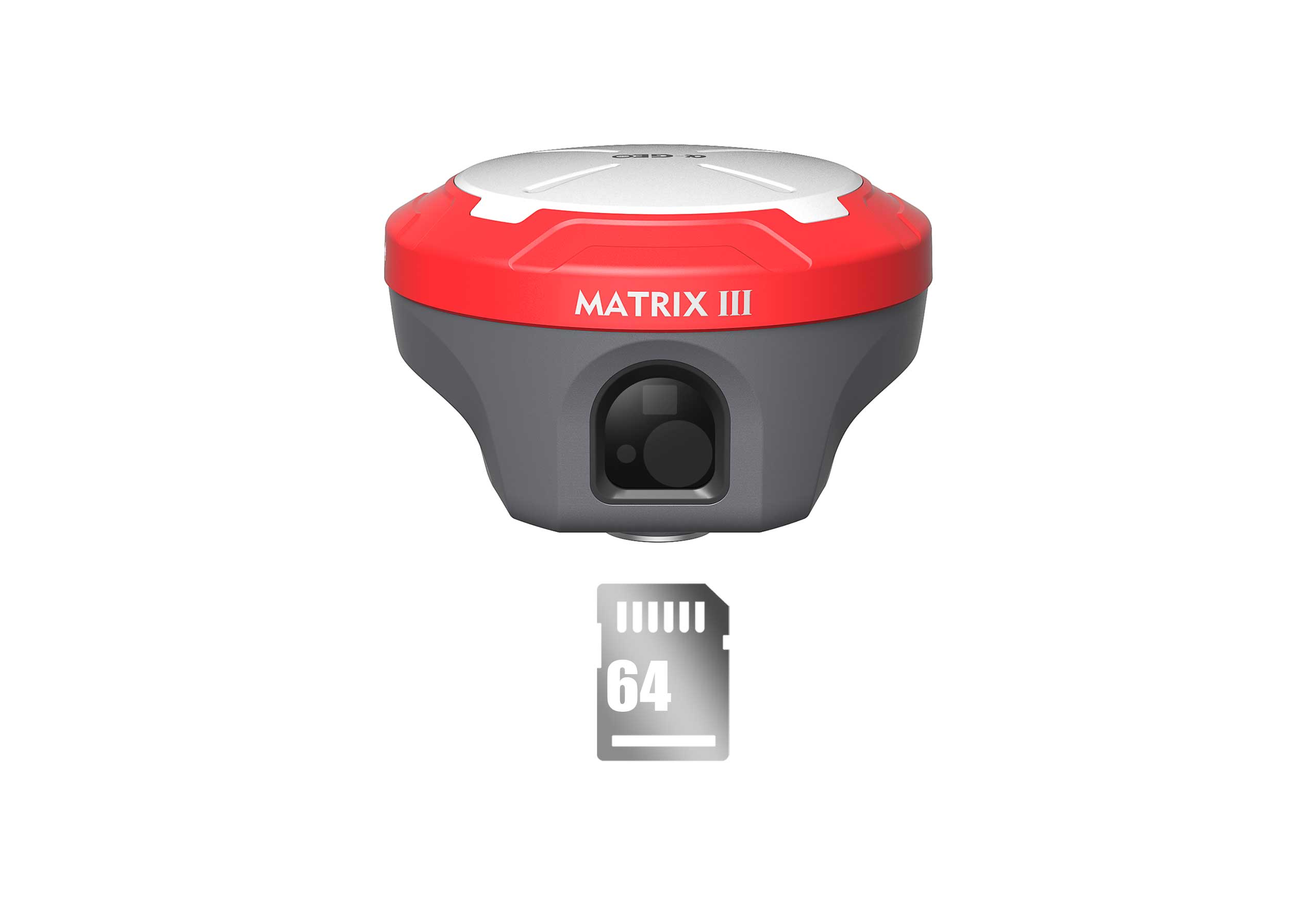
Worry-free storage
Built in 64GB memory, which can meet most needs of field work. And the feature of cyclic storage helps receiver to automatically remove the previous observation data while there is not enough space in the memory, with this excellent performance, data storage can last almost 4 years based on 5s sampling interval. And the design of embedded memory chip can ensure the safety of observation data.
| GNSS Performance | Signals tracking | GPS:L1C/A,L2C,L2P, L5 |
| GLONASS:L1,L2 | ||
| BDS:B1,B1C,B2,B2a,B2b,B3 | ||
| GALILEO: E1,E5a, E5b, E6 | ||
| QZSS:L1, L2, L5, L6 | ||
| SBAS:WAAS,EGNOS, MSAS,GAGAN, SDCM | ||
| Channels | 1408 | |
| Cold start | <60s | |
| Hot start | <15s | |
| Positioning output rate | 1Hz~50Hz | |
| Signal reacquisition | <1s | |
| RTK initialization time | <5s | |
| Initialization reliability | >99.99% | |
| Time accuracy | 20ns | |
| Positioning accuracy 1 | Code differential GNSS positioning | H:0.25m +1ppm RMS |
| V:0.50m+1ppm RMS | ||
| SBAS differential positioning accuracy 2 | Typically<5m 3DRMS | |
| Static GNSS surveying | H:2.5mm+0.5ppm RMS | |
| V: 5mm + 0.5ppm RMS | ||
| RTK surveying(baseline<30km) | H: 8mm + 1ppm RMS | |
| V:15mm + 1ppm RMS | ||
| Network RTK³ | H: 8mm + 0.5ppm RMS | |
| V:15mm + 0.5ppm RMS | ||
| Laser measurement | +2mm+100x10-6xD (D is the measuring distance, unit : mm) | |
| Laser distance | 0.05m~100m | |
| Sensor | IMU | Supported, 4DlMUinitializationin 3 seconds |
| Update rate | 400Hz | |
| Accuracy | <2.5cm within 120° | |
| Tilt compensation | 0~120° | |
| Camera | Laser assisted | 5MP HD camera |
| AR camera | 5MP | |
| FOV | 84° | |
| Physical | Materials | Magnesium alloy |
| Dimensions | 129mmx129mmx99mm | |
| Weight | <0.8kg | |
| Operating temperature | -40℃~+75°C | |
| Storage temperature | -55℃~+85°C | |
| Waterproof/Dustproof | IP67 standard, protected from30min immersion to depth of 1m | |
| Shock | Survive a 2m pole drop ontoconcrete | |
| Vibration | MIL-STD-810G | |
| Humidity | 100% non-condensing | |
| Eletrical | Power supply | 9~24V DCexternal powerinputto 5-pin LEMO portSupports Type-C fast charging |
| Battery | Built-in 7000mAh-7.4V Li-ion battery | |
| Battery life | Rover mode: 12hours | |
| Base mode: 7hours | ||
| Static mode: 15hours | ||
|
Communications |
l/O interface |
1*5-pin LEMO port, powersupply,RS232,external radio communication port |
| 1* uSB Type-C port, charging, data download | ||
| 1* SlM card slot, Nano SlM | ||
| 1* UHF antennainterface | ||
| Internal UHF | 1.5W receiver and transmitter | |
| Frequency band | 410MHz~470MHz,supports frequency modification | |
| Protocols | Trimtalk450S,Alphatalk15, South,Satel,PCC-EOT | |
| Cellular network | Full frequency multi-band 4G modem, supports TDD-LTE/FDD-LTE/WCDMA/CDMA2000 | |
| WiFi | 802.11 b/g standard,access point & client mode,supports accessing to hotspot for correction transmission | |
| Bluetooth | Bluetooth 5.2 classical/BLE proprietary dual-mode | |
| Differential data format | RTCM2x, RTCM3x,CMR&CMR+,sCMRX | |
| GPS output data format | RINEX,NMEA-0183 | |
| Date storage | Memory | 64GB, supports cyclic storage with ability to collect almost 4 years raw observation based or 5s interval |
|
User interaction
|
Operating system | Linux OS |
| Buttons | Power key | |
| Indicators | 1*Powerindicator | |
| 1*Bluetooth indicator | ||
| 1* Satellite indicator | ||
| 1*Data linkindicator | ||
| Voice | Intelligent voice prompts | |
| Web ul | Supports Web Ul configration |
Hot Tags
Related Products


Get a free quote in 24h
Rest assured that your privacy is important to us, and all information provided will be handled with the utmost confidentiality.
α-GEO, founded in 2008, is a global market-leading high-tech company focusing on high-precision GNSS technology.
alphageognss
alphageo
alphageoinfo