


About us
Guangzhou Alpha Geo-Info Co., Ltd.
AlphaGEO brings together a group of partners with nearly 20 years of industry experience and a passion for surveying and mapping. We consistently adhere to independent R&D and "Made in China" principles, aiming to build a new force in the industry and drive its positive development.
In 2020, we launched our global expansion, focusing on the R&D and industrialization of high-precision GNSS-related products.
By 2026, leveraging our technological and market experience, we aim to establish a development model encompassing "hardware + software + digital services," committed to providing more professional and comprehensive solutions for the global surveying and mapping industry.
%
Customer satisfaction
+
More than 50 countries around the world
+
Number of users by industry
+
Measurement experience
Matrix VI
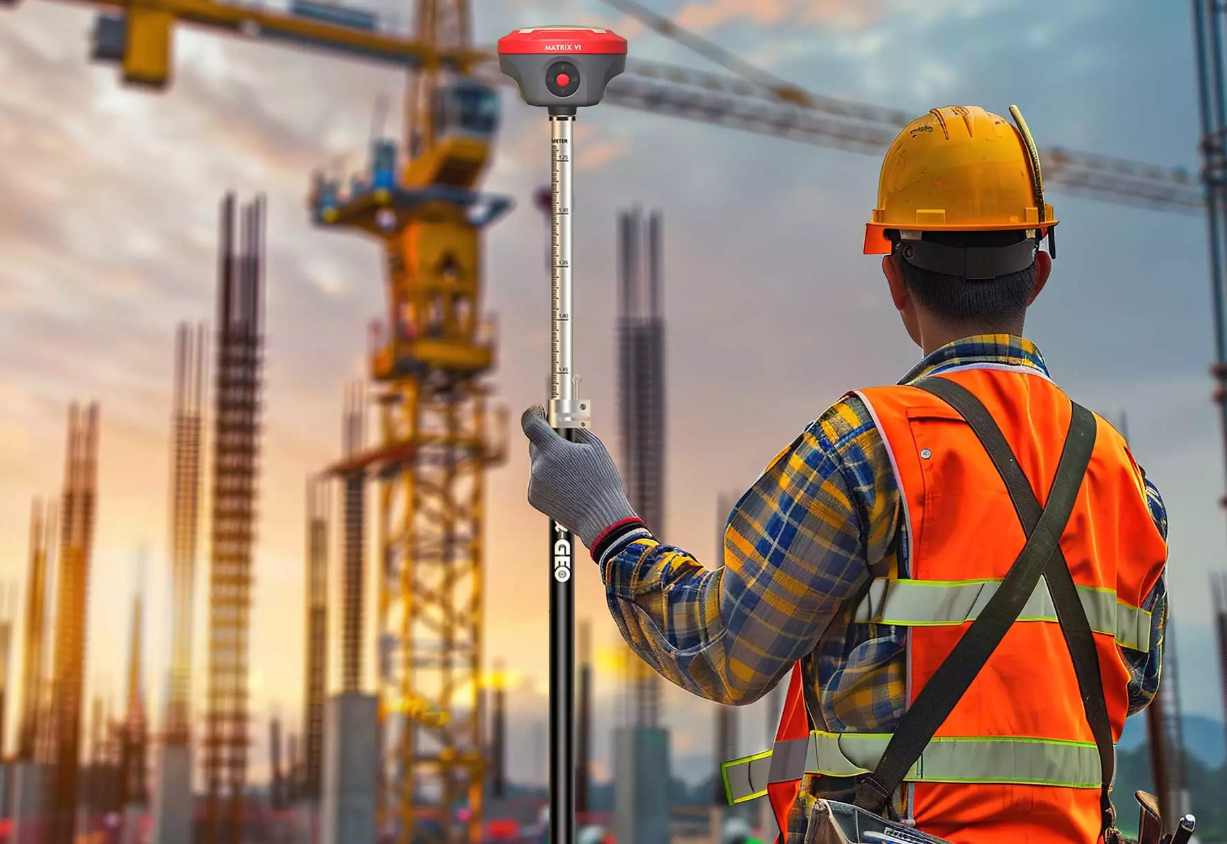
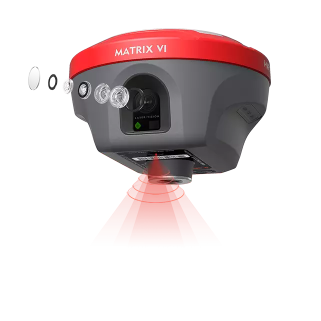
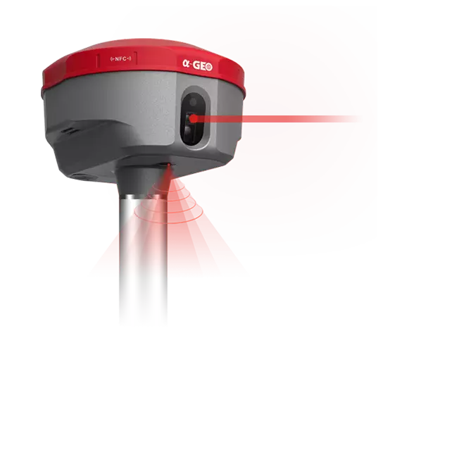
Matrix Vl is a brand new functional GNSS receiver merges Visual Positioning, AR real-scene stakeout and Laser measurement technologies,once breaking through the limit ations of GNSS products, offering surveyors more convenience and productive solutions.
Measuring as sharp as eyes Matrix Vl, a survey-grade GNSS receiver, merges visual positioning technology with built-in core algorithms of photogrammetry, offering productive solutions for professional or amateur surveyors to measure points that previously could not be measured with regular GNSS RTK easily.
The surveyors can quickly capture the site with a set of images or a video and measure the points' coordinates from them, no matter if they are in the field or later in the office.
The side camera is not just for photogrammetry; it is also an assistant for laser measurement. When using laser measurement, the laser spot cannot be clearly seen, whether it is on the measured point in the strong light conditions. The camera, as the eye of the instrument, can provide real-time images to determine whether the laser spot has been aimed at the measured point or object.
Laser surveying opens a new mode of measurement
The world's exclusive patented laser coordinate measurement quick calibration technology can easily achieve centimeter-level measurement accuracy, making measurement more accurate and user-friendly. Besides, the camera used in the equipment overcomes the difficulty of aiming under sunlight, making field measurement operations faster and more efficient.
Safer measurement
With the laser measurement, Matrix Vl is able to minimize the risks or avoid dangers during surveying along the side or central areas on the road with heavy traffic, high-voltage towers, and transformers, with the laser aiming at the measured point and maintaining a certain safe distance from these dangerous locations.
Right to the point with AR real-scene stakeout
When the stakeout points are marked directly on the ground, surveyors can easily find the exact location of the stakeout points; by following the arrows on the real-life map, they can stake out points in one go without having to move the pole back and forth, making the stakeout work more accurate and efficient.
Goes with powerful GNSS performance
Empowered by a powerful signals tracking algorithm and with the 1408 channels of the GNSS engine, Matrix Vl is able to track enormous signals of all running satellite constellations, which improves the fixed rate and speed so that you don't need to wait for a long time to get a fixed solution as used to be.
With the built-in proprietary narrowband interference mitigation technology, that is more than enough to let you easily navigate in complex environments, such as in the thick forest or beside the high buildings; the accuracy can be ensured.
Matrix II
MATRIX II is a compact new generation of smart laser AR RTK designed for any surveying project using the latest GNSS technology.This receiver is equipped with all modern required connectivity modules: Bluetooth, Internal radio, WIFI & 4G modem.7000mAh Built-in battery, IMU tilt technology and WebUl are other latest technologies used in MATRIX II receiver.
AR Right to the point with AR real-scene stakeout
When the stakeout points are marked directly on the ground, surveyors can easily find the exact location of the stakeout points. By following the arrows on the real-life map, you can stake out points in one go, without having to move the pole back and forth, making the stakeout work more accurate and efficient.
Lixel K1
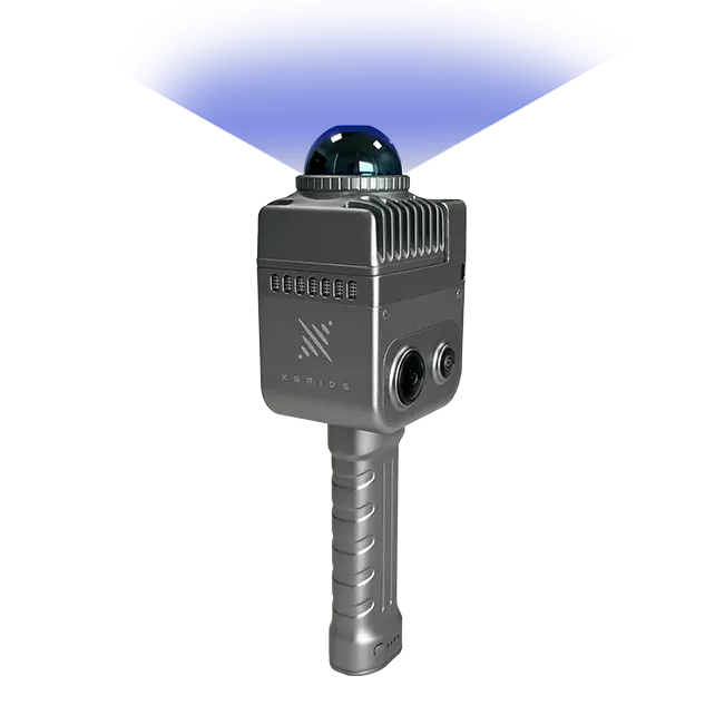
Lixel K1 is a compact handheld scanning and modeling device newly announced. With a lightweight body, it integrates 56 million-pixel panoramic vision modules and a 360° LiDAR, capable of real-time generation of centimeter-level colored 3D models. Tailored for professionals, small to medium-sized businesses, and 3D enthusiasts, it offers a convenient solution for 3D capture and modeling.
Compact & Lightweight Adopting the aluminum alloy material for K1’s body makes its weight only 1 kg, including the battery, extremely light and convenient to carry, and easier for work. Collect as you like The built-in IMU sensor allows you to hold the device at a certain tilt angle for scanning without having to keep the body upright, making the operation easier.
L2 Plus
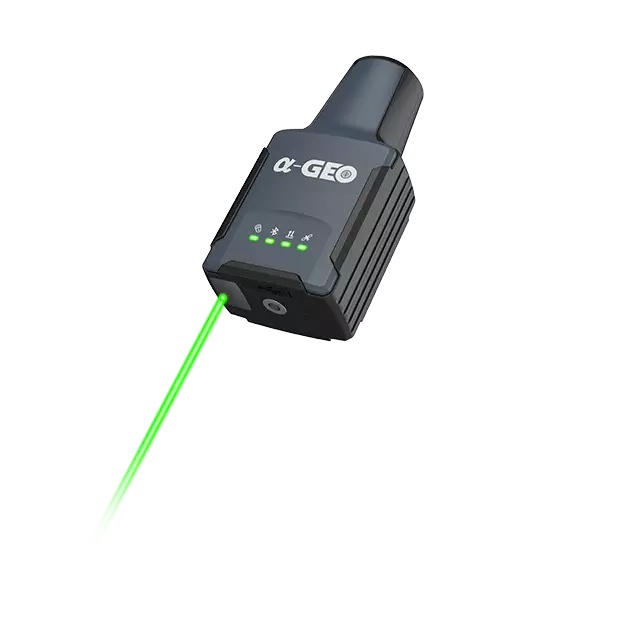
As the saying goes, a sparrow may be small, but it has all the vital organs, same as to the L2 Plus of Alpha GEO, itis the smallest handheld RTK that integrates laser along with high-precision GNSS board and lMU in the compact body, offering a portable solution for most measurement scenarios.
Unforgettable at first sight L2 Plus impresses with its unique design and ultra-small body size; the dimension of this RTK receiver is only 61(L)x41(W)x120(H) mm. Such a small-sized RTK receiver can take the place of a cellphone, so putting it into the pocket is not a problem. And the weight of L2 Plus is only 170 g, including the internal battery, extremely lightweight so that you almost don't feel tired while you hold it for a long time in the field work. The housing of L2 Plus is made of polymer engineering materials, which have the advantages of high strength, high temperature resistance, and corrosion resistance, performing well in complex environments.
Alpha ARK
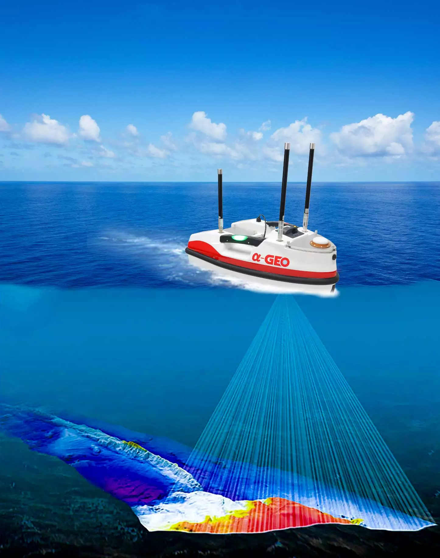
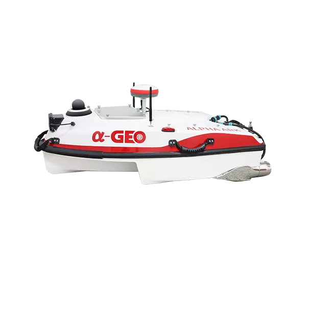
Alpha ARK is made of Kevlar & carbon fiber composites with a M-type trimaranboat shape which has strong resistance to impact. lts closed-cell foam filling andfully enclosed compartments are anti-sinking and waterproof design. The modulardesign is easily assemble and disassemble all parts for maintenance. Alpha ARKequip with different sensors to perform a variety of tasks according to demand andeasily cope with a variety of complex operating conditions with multiple securityprotection mechanisms!
Great ability against wind and waves & excellent seaworthiness Alpha ARK experiences a trapezoidal-shaped trimaran with great seaworthiness and stable sailing ability. The high-speed air flow enters the channel from the horn and forms an air cushion to generate additional lift that reduces the forward resistance to make it easy to accelerate when sailing.
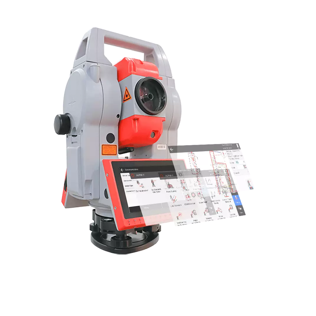
ALPHA Y
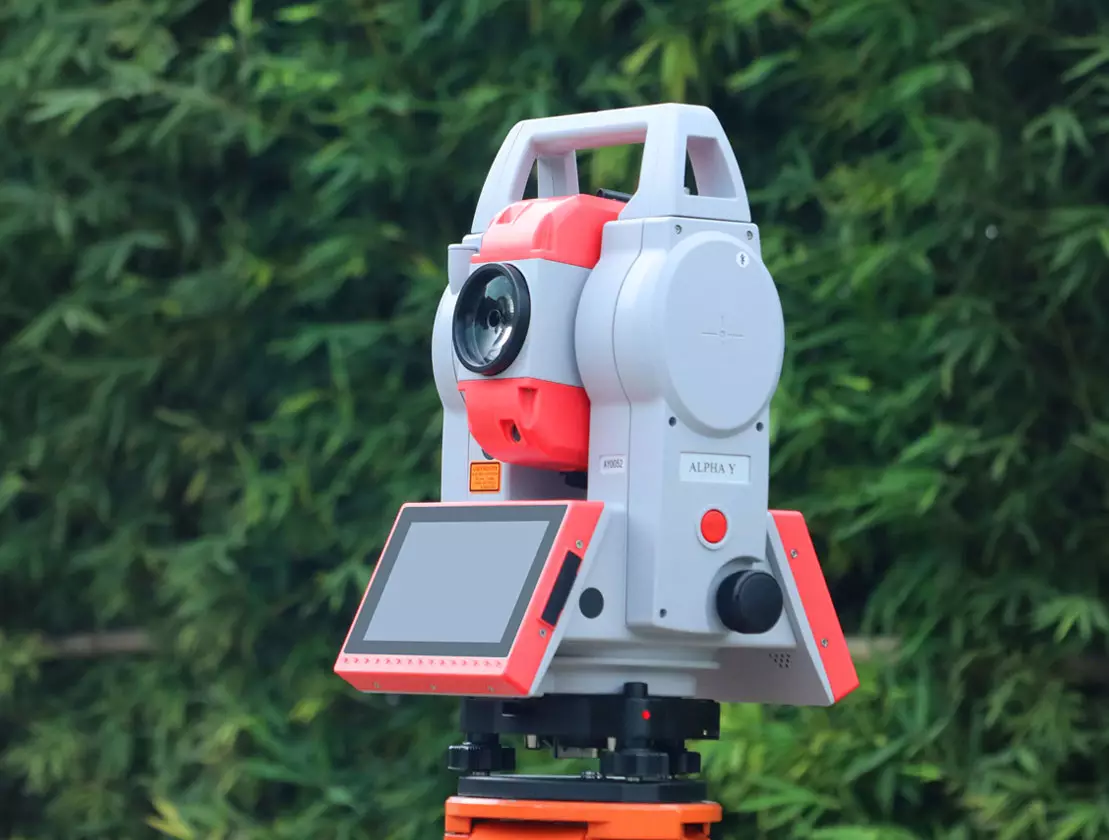
With the advantage of Android operating system ,ALPHA Y have the quick accessibility to 3rd party software like Surpro 6.0 onboard, with the powerful Surpro 6.0 software ,It can turn many impossible measurement functions into reality. With endless drive ,ALPHA Y can achieve rapid aiming of the target,which greatly improved the efficient of the work.
Intelligent operating system Android 11 system with an open platform and strong scalability, which can customize apps according to the needs of different industries. Strong performance, smooth operation Equipped with a quad-core processor and ARM Cortex-A55 architecture, it can clock up to 2 GHz.
Variety of communication modes
Bluetooth, Wi-Fi, USB disk, Type-C, and 4G full network (optional).
Extra memory and storage
4G RAM + 32G ROM (expandable to 8G + 128G), running smoothly without lag.
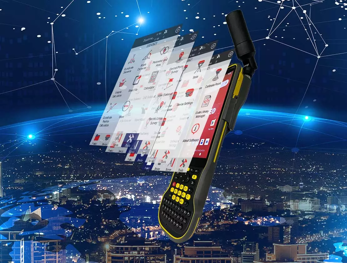
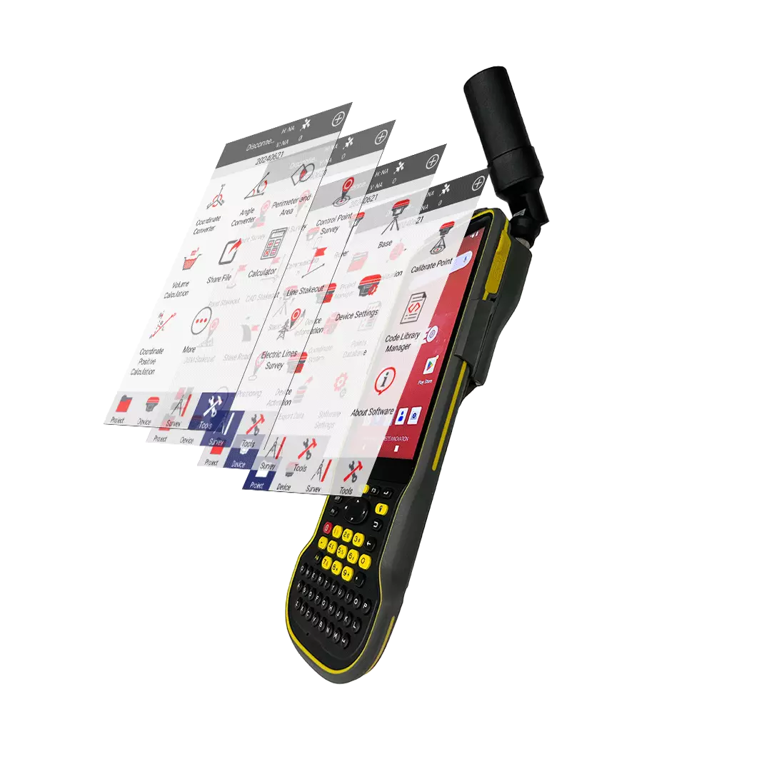
S60III PRO
The S60III pro RTK handheld terminal is the ultimate solution for enhancing efficiency and productivity in mobile field operations. With centimeter to decimeter-level positioning accuracy, it is an extremely portable, durable, and versatile device, ideal for precision GIS data collection, power line inspections, construction site development, environmental research, landscaping, and various other applications. Equipped with a 5.5-inch sunlight-readable display, users can easily view GIS data tables, complex vector and raster maps, and high-resolution images even in bright sunlight and high-light conditions. Its industrial design, compliant with the IP68 standard, ensures reliable performance in extreme and challenging environments, making it the preferred choice for field professionals, particularly those with demanding equipment requirements.The S60III pro integrates precision GNSS positioning technology and long-range RFID technology, empowering efficient data collection for both individual operators and large field teams.
Leading Industry Data Collection Terminal Powered by Android 12 OS with GMS Certification. The S60III Pro is equipped with the Qualcomm 662 processor, designed with an 11 nm fabrication process, providing powerful performance for smooth CAD drawing management and base map display, greatly enhancing productivity. Dual-band Wi-Fi and 4G support ensure stable and reliable internet connectivity, while the physical USB 3.0 interface allows for faster data transfer, enabling instant uploads of large project files.
Why Choose Us
Make your work more efficient and pursuethe best GNSS technology and solutions forglobal users.
Make your business smarter, faster, moreflexible, and more profitable.
Vision
Create the future of GNSS application with reasonable price and excellent technology
Mission
Transforming the Ordinary into the Extraordinary

Goal
Work hand in hand with global dealers for mutualbenefit and win-win results
Have a question
before your project?
Dear, Fill in the contact form, and I will reply in 12 hours. All your messages are protected!



alphageognss
alphageo
alphageoinfo