


Compact Handheld 3D Scanner Lixel K1 for 3D capture and modeling


Features
Compact & Lightweight
A dopting the aluminum alloy material for K1 ’ s body, makes its weight only 1kg including the battery, extremely light and convenient to carry, easier for work.

Multi-line lidar, panoramic collection, no omissions
Equipped with a 40-line lidar with a point rate of 200,000 points /sec, 360° laser horizontal FOV , captur ing richer details of objects and no omissions for scanning . More over, t he ±1.2cm accuracy and 40m measurement distance can meet the demands of the most scenes .
Real-time true color, delicate presentation
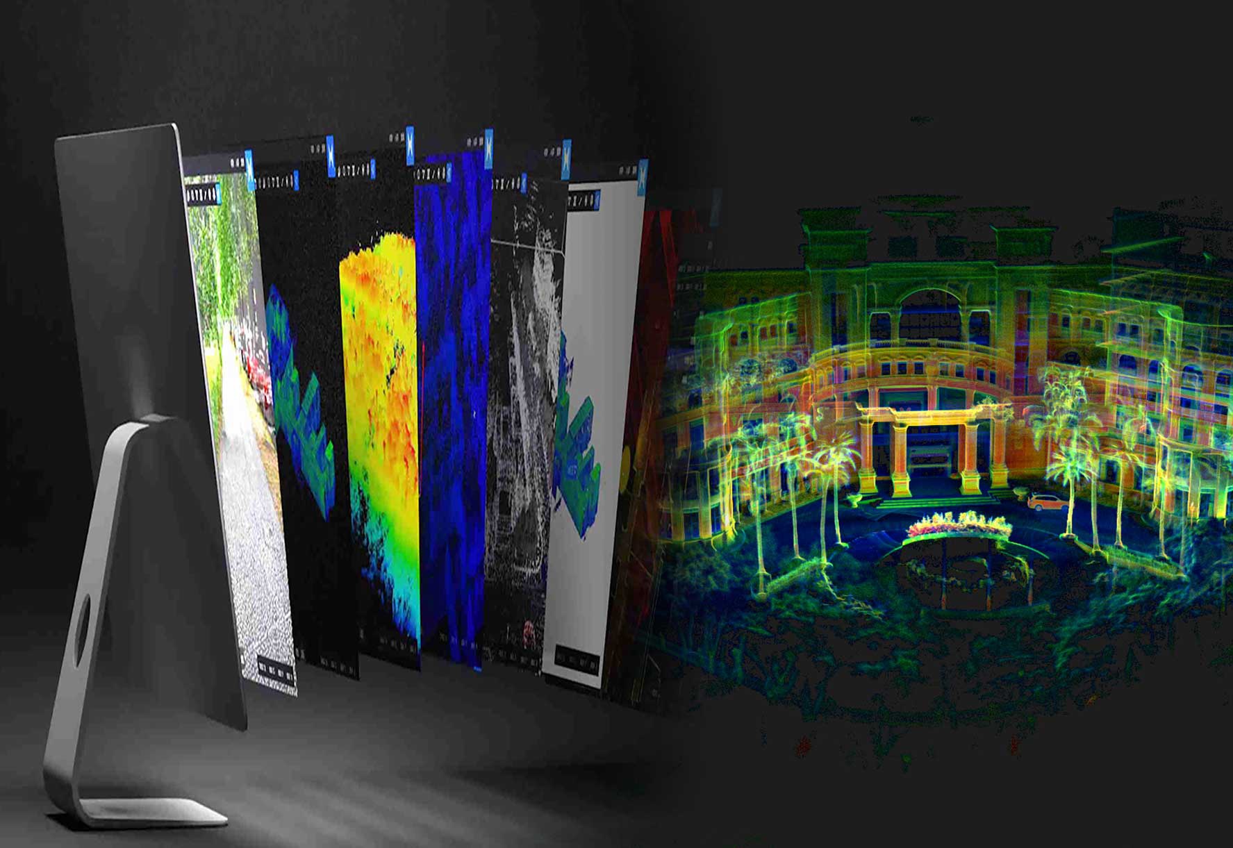
H ighly integrated with 56 MP panoramic vision module , realize the 360°*360° true panoramic vision, coupling with high-performance computing module , the more exquisite and excellent real-time true color point clouds can be provided on controller APP.

Collect as you like
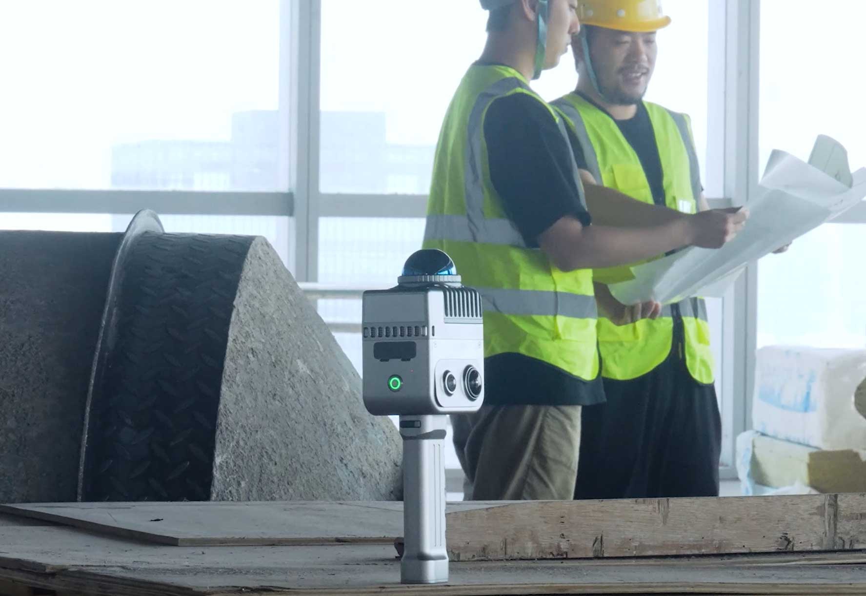
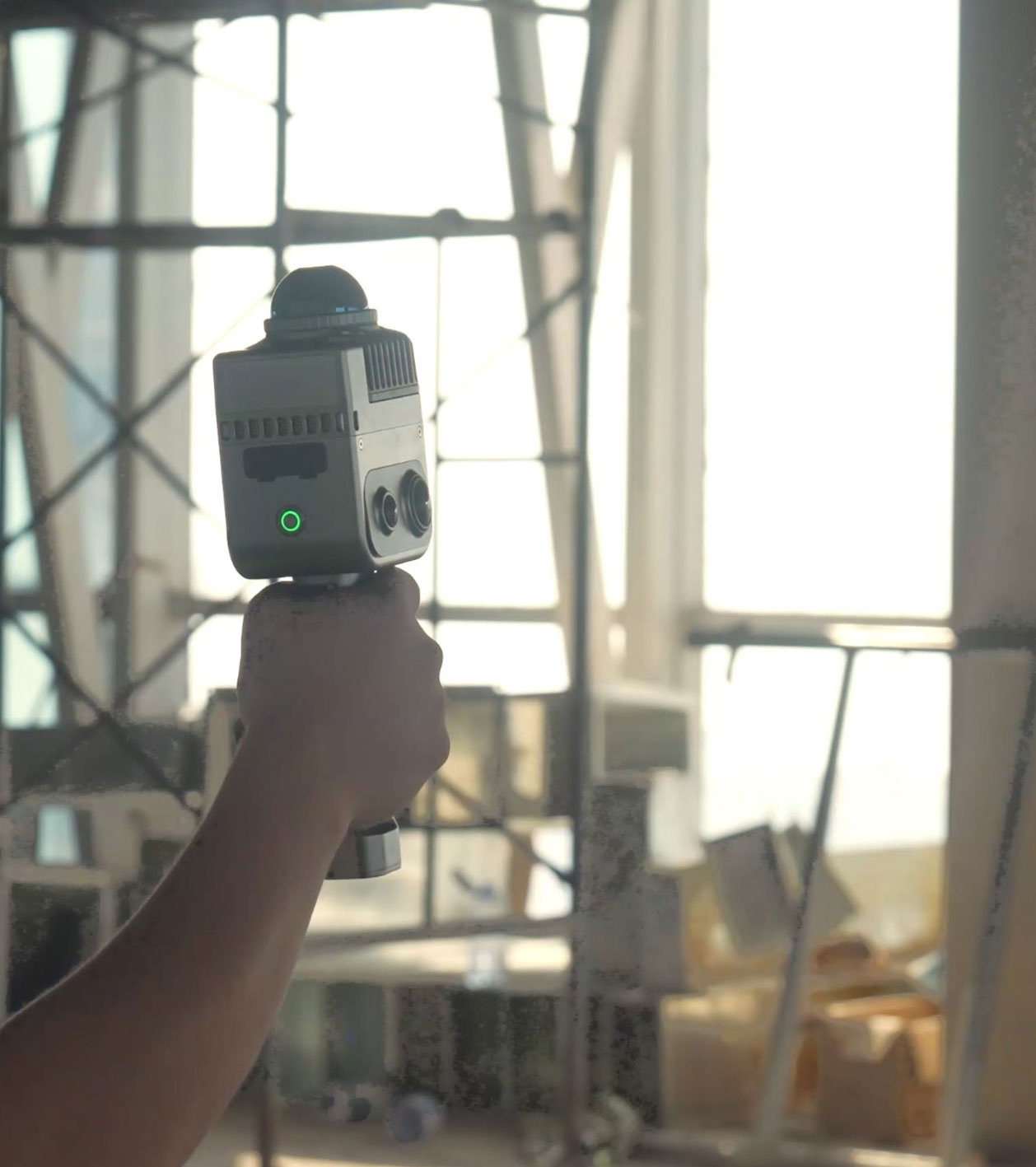
B uilt-in IMU sensor allows you to hold the device in a certain tilt angle for scanning without having to keep the body upright, making the operation easier.

Easy of use, and economic
T he operation of K1 is easy to learn and understand, that can make the ordinary people become professional talents of 3D scanning and modeling. A single person can efficiently complete outdoor scanning missions , greatly boosting the productivity .
Application scenarios
-
 Digital Twins
 -
 Engineering Survey
 -
 Filming & Gaming
-
 Scan to Bim
 -
 Agriculture & Forest
 -
 Culture & Tourism
Software kit
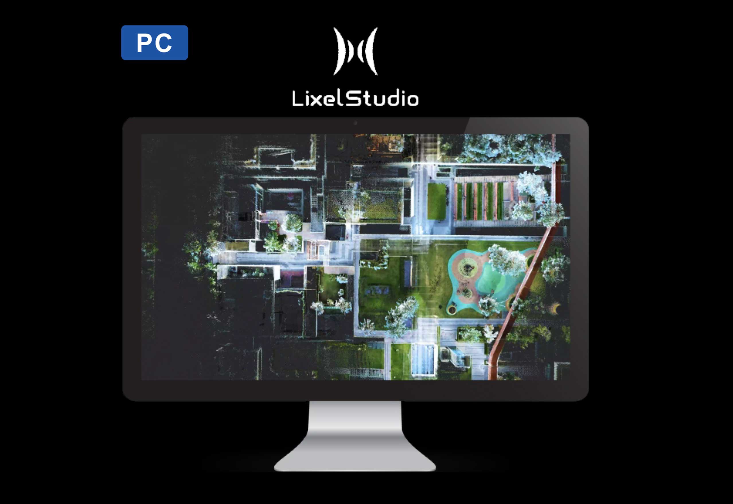
PC
An all-in-one 3D post-processing software offers a range of features, including point cloud viewing, editing, modeling generation,and post-processing
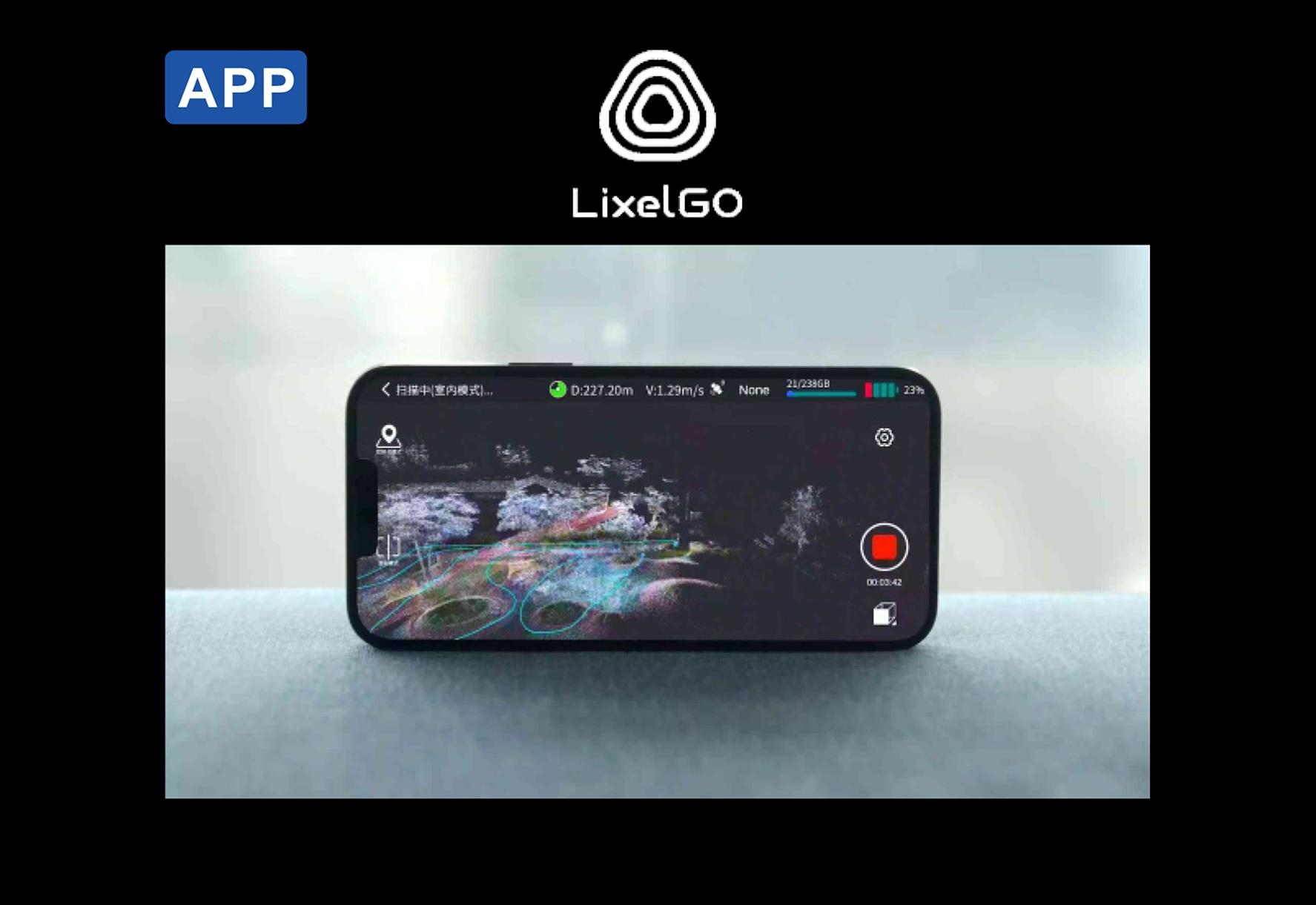
APP
It is a mobile APP for the regular scanning work-flow operation, preview of scanning results, and one-screen monitoring of device status
Specifications
| Scanning performance | Laser channels | 40 |
| Laser class | Class 1/905nm | |
| Relative accuracy | +1.2cm | |
| Absolute accuracy | ≤3cm | |
| Repeat accuracy | ≤2cm | |
| Horizontal accuracy | 0.015° | |
| Working range | 0.1m~40m @10%,70m@80% | |
| LiDar FOV | 360°x-7°~+52° | |
| Scanning mode | Mobile | |
| Scanning speed | 200,000 points/second | |
| Resume scanning from break point | Supports | |
| Visual module | Camera FOV | Color panorama HDV 360°x360° |
| Camera resolution | 56 Mega Pixel | |
| Data & storage | Processing mode | Real-time calculating/Mixed calculating |
| Software kit | Lixel Studio (Windows), LixelGo (Android) | |
| Point cloud format | *.las | |
| Color point cloud | Supports | |
| Hardware performance | Power input | 14.4V |
| Power consumption | <20W | |
| Dimensions(main body) | 87mm(L)x65mm(W)x133.1mm(H) | |
| Weight | 1kg | |
| Data interface | Type-C USB3.1 Gen2 | |
| Storage capacity | TF card 256GB(Replaceble) | |
| Connection mode | WiFi/Bluetooth | |
| Operating temperature | -20℃~+50°C | |
| Protection level | IP54 | |
| IP54 | Navigational aluminum | |
| Power supply | Fast-lock battery/external power | |
| Operating time | 1.5 hrs | |
| Battery capacity | 28.8wh | |
| Number of camera | 4 | |
| Visual-aided positioning | Supports | |
| APP WiFi distance | 20m | |
| RTK mode | Supports |
Hot Tags
Related Products


Get a free quote in 24h
Rest assured that your privacy is important to us, and all information provided will be handled with the utmost confidentiality.
α-GEO, founded in 2008, is a global market-leading high-tech company focusing on high-precision GNSS technology.
alphageognss
alphageo
alphageoinfo