1743993325_noD3WdT6GP - alphageo
1743993785_puFwc9yxTP - alphageo
1743994021_2FXzR4ANS0 - alphageo
1743994492_ny5Qg1RPHE - alphageo
1743995307_bThdubSoQ5 - alphageo
1743995415_2aAIV2fkAT - alphageo

High-precision RTK GNSS receivers and software

Alpha set out to make professional GNSS equipment accessible without compromising accuracy or reliability. Today, more than 20,000 users worldwide rely on our receivers, from construction sites to drone surveys and from agriculture to geophysics, proving that high-precision positioning can be both powerful and affordable.

1739175803_hE3AF4xH04 - alphageo

Receivers

Android Total Station ALPHA Y with Surpro 6.0 onboard for enginee - alphageo

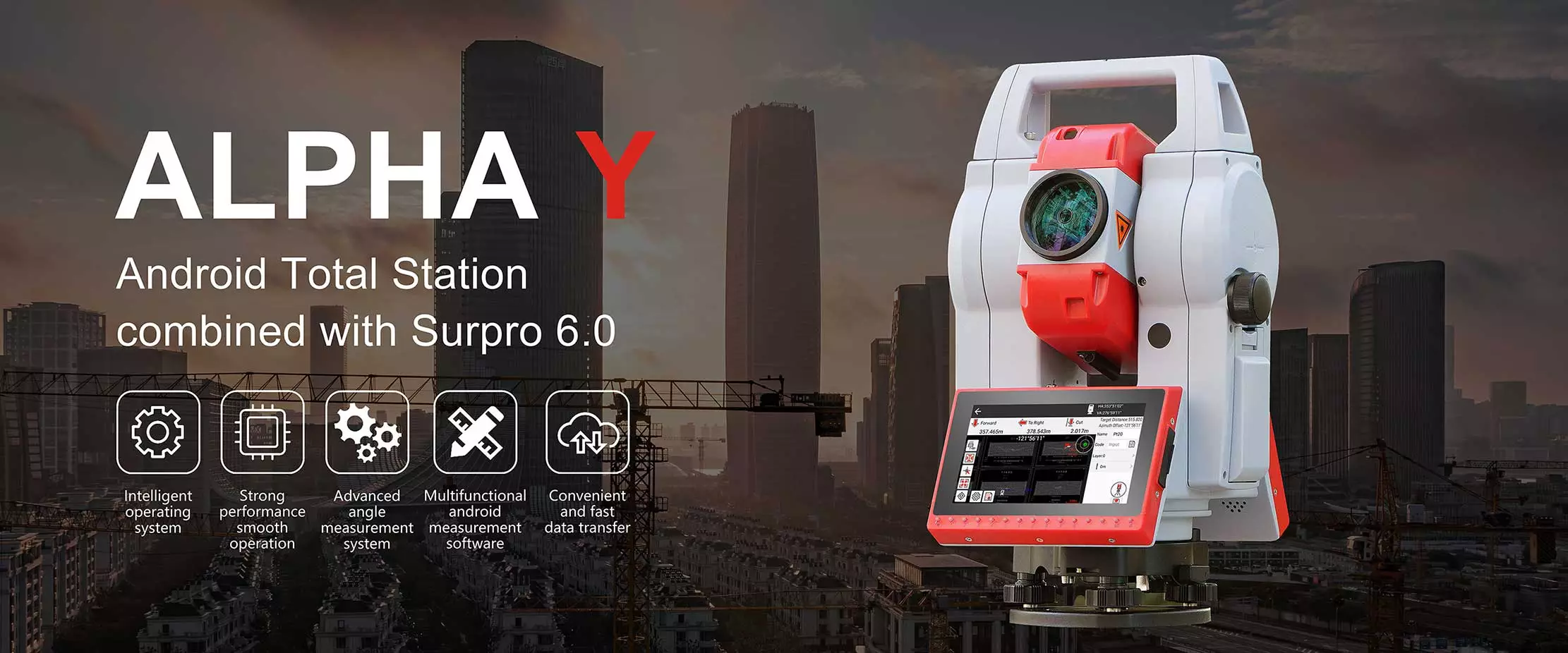
Alpha Y

With the advantage of the Android operating system, Alpha Y has quick accessibility to 3rd-party software like Surpro 6.0 onboard. 

With the powerful Surpro 6.0 software, it can turn many impossible measurement functions into reality. With endless drive, Alpha Y can achieve rapid aiming of the target, which greatly improved the efficiency of the work.

high-precision-monitoring-colibri-ii-with-dual-axis-tilt-function -1 - alphageo

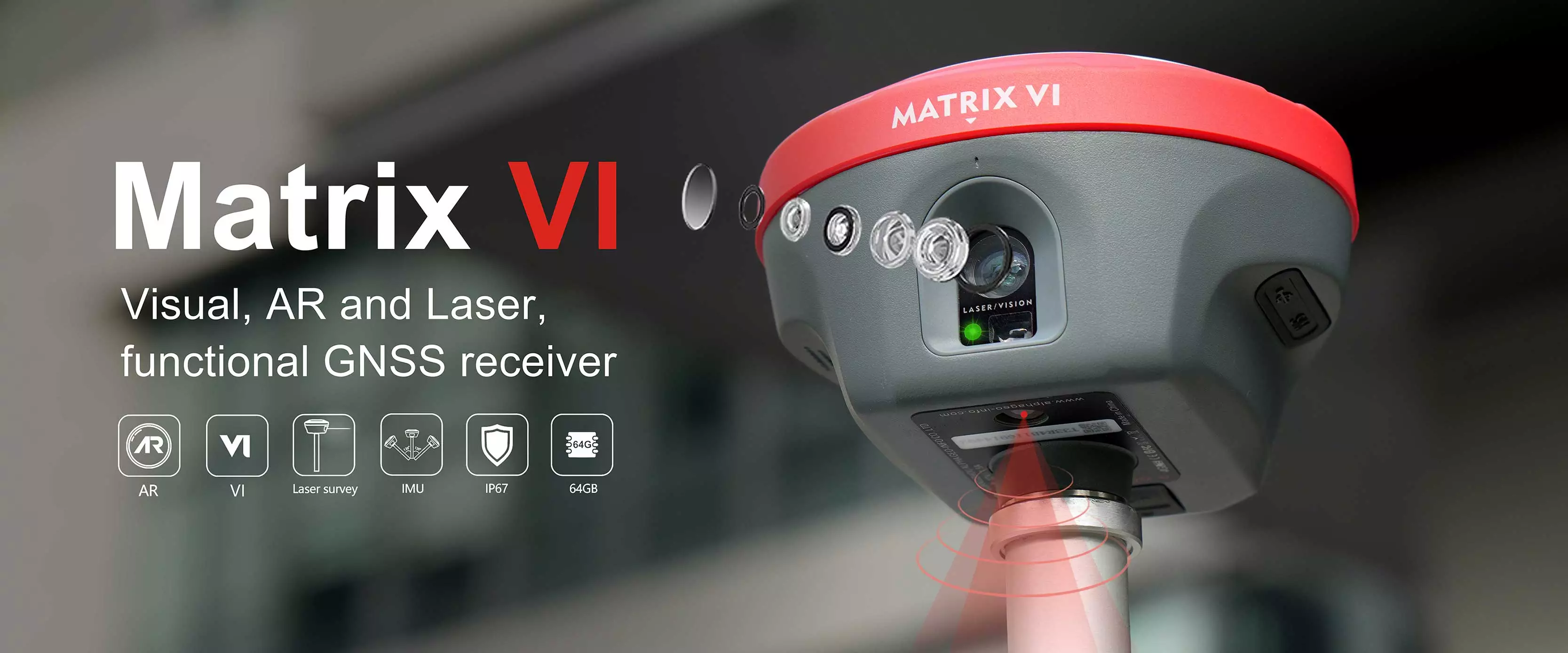
Matrix VI

Matrix VI is a brand new functional gnss receiver merges visual positioning, ar real-scene stakeout and laser measurement technologies,once breaking through the limit ations of GNSS products, offering surveyors more convenience and productive solutions.

small-size-usv-system-alpha-ark-s-for-underwater-survey-2 - alphageo

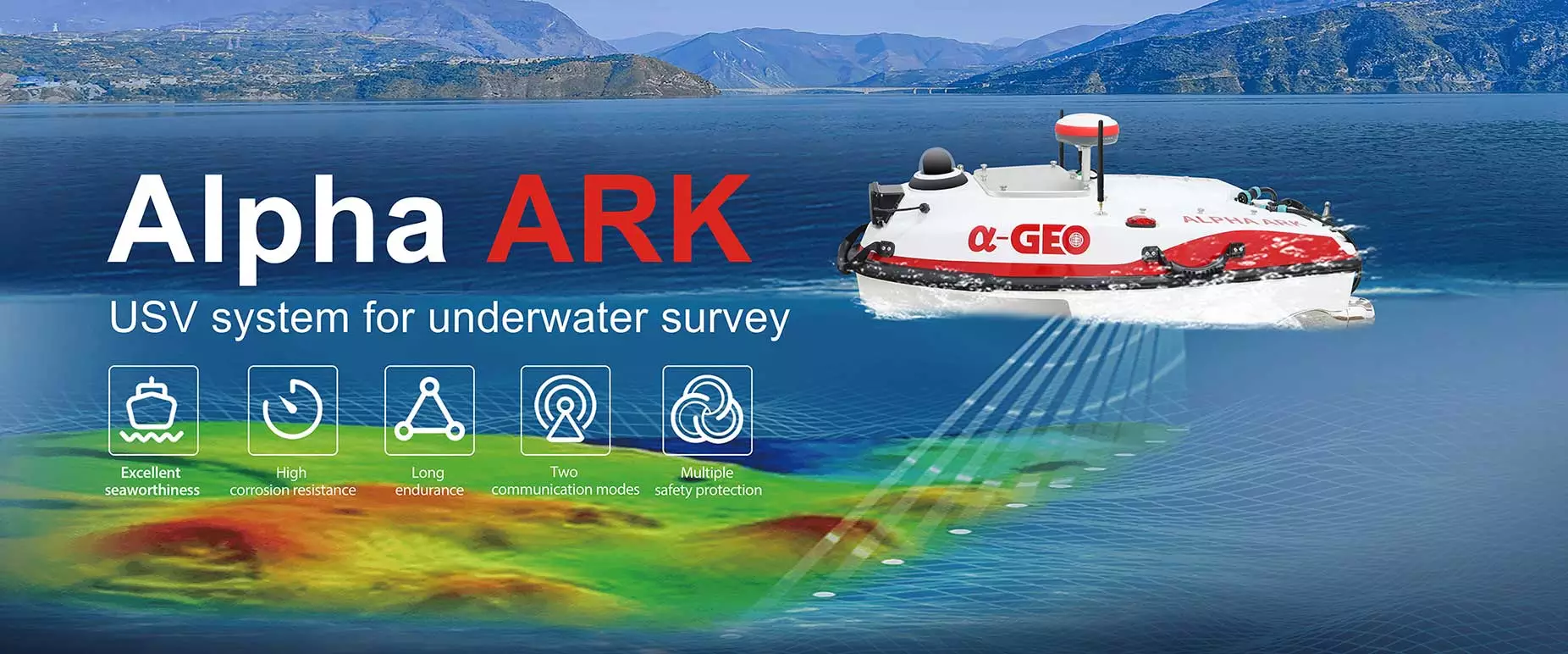
Alpha ARK

The Alpha Ark is made of Kevlar & carbon fiber composites with an M-type trimaran boat shape, which has strong resistance to impact. Its closed-cell foam filling and fully enclosed compartments are anti-sinking and waterproof in design. The modular design easily assembles and disassembles all parts for maintenance. Alpha is equipped with different sensors to perform a variety of tasks according to demand and easily cope with a variety of complex operating conditions with multiple security protection mechanisms!

Drone-based surveying & mapping

Set up a base station and collect GCPs with Reach RS3

Buildings - alphageo
Works online & offline
ArrowsOutLineHorizontal - alphageo
Free GCP collection in Emlid Flow
BuildingApartment - alphageo
RTK & PPK drones
Binoculars - alphageo
Free PPK photo geotagging in Emlid Studio

Provides high precision for your UAV, regardless of cellular coverage or distance from urban areas. To collect ground control points, connect a second Reach RS3 or Reach RX2.

White drone flying over a parched desert area against a blue sky - alphageo

Reach RS4 Pro and Emlid Flow for accurate site work

Emlid Flow lets you work with CAD files and DTMs, collect and stake out points, calculate geometry, and ensure structures are positioned exactly to plan. With cloud-based Emlid Flow 360, your field and office always stay in sync.

Paired with Reach receivers, you get centimeter accuracy – even when tilted – and a battery that lasts all day, ensuring reliable performance in the field.

Survey codes / WMS / Inverse & Traverse / DTM / Stakeout reports / DXF, SHP, CSV / Auto Collection / Cloud sync

Centimeter-accurate GIS data

Improve geodata accuracy with Reach RX2

Compact receiver for collecting lots of data quickly, every day. Designed to deliver high accuracy even tilted. No need for extensive GPS and GNSS expertise.

Mode    

Buildings - alphageo
Automatic dimming
ArrowsOutLineHorizontal - alphageo
Daylight saving adjustments
BuildingApartment - alphageo
Motion sensor integration
Workers working on the grey area of oil producing - alphageo

Mobile terrestrial scanning

Capture 3D models with a smartphone and Reach RX2

Attached to a portable handle, Reach RX2 provides RTK accuracy and integrates with iPhone and Android scanning applications.

Pix4D & Emlid scanning kit

The ready-to-go solution: get high-precision coordinates from Reach RX2 and powerful photogrammetry from Pix4D.

Software for the field and the office

Alpha set out to make professional GNSS equipment accessible without compromising accuracy or reliability. Today, more than 20,000 users worldwide rely on our receivers, from construction sites to drone surveys and from agriculture to geophysics, proving that high-precision positioning can be both powerful and affordable.

n_banner - alphageo
Icon_dots - alphageo

Resources

Resources Blog & News

Stay updated with expert insights, industry news, technical guides, and company updates.

Our Resources Blog & News delivers timely, valuable content.

News
ALPHAGEO releases MATRIX VI: Innovative panel design reshapes brand genes, ALPHA spirit defines industry benchmark

ALPHAGEO, a global leader in geophysical exploration technology, today officially released the latest masterpiece of its flagship MATRIX series - MATRIX VI high-precision seismic imaging system. This upgrade not only brings a leap in performance, but also significantly improves the brand's visual recognition with a subversive panel design innovation, deeply imprinting the enterprising spirit of "ALPHA" into the product.

07/25/2025
Details ››
ALPHAGEO releases MATRIX VI: Innovative panel design reshapes brand genes, ALPHA spirit defines industry benchmark
News
ALPHAGEO Unveils A-Tab: Powerful, Sunlight-Visible Data Collector for Demanding Field Operations
The A-Tab represents a significant leap forward, integrating the latest industrial-grade processing power into a remarkably slim and user-friendly form factor. Designed specifically for professionals requiring robust performance outdoors, the A-Tab features a standard English keyboard, enabling...
07/25/2025
Details ››
ALPHAGEO Unveils A-Tab: Powerful, Sunlight-Visible Data Collector for Demanding Field Operations
News
ALPHA R1 Robotic Total Station Launched: Precise Remote Control, Efficient Single-Operator Operation
Recently, the global surveying and mapping field witnessed a major technological breakthrough—the official release of the next-generation ALPHA R1 Robotic Total Station. This equipment, featuring a precise remote control system and a revolutionary single-operator mode, redefines efficiency sta...
07/25/2025
Details ››
ALPHA R1 Robotic Total Station Launched: Precise Remote Control, Efficient Single-Operator Operation
News
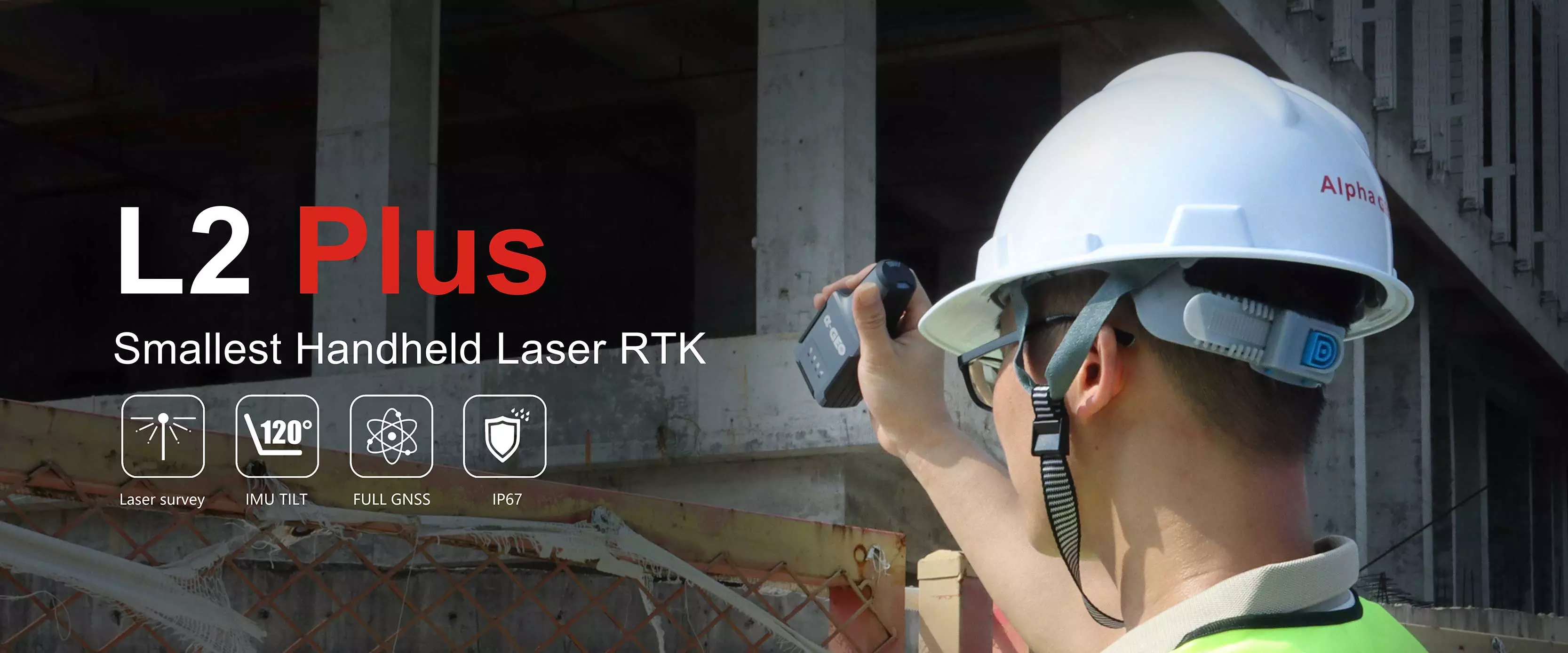
Redefines surveying portability, Polar-Tested Minimal Handheld RTK
Redefining portability in surveying, ALPHAGEO L2Plus, the world's smallest handheld laser RTK, successfully validated in Polar conditions AlphaGEO L2 Plus Handheld Laser RTK Successfully Completes High-Precision Surveying in Arctic Extremes, Reinforcing "Compact Yet Powerful" Design Philosophy。 As...
07/03/2025
Details ››
Redefines surveying portability, Polar-Tested Minimal Handheld RTK

/ Blog

Stay Ahead With the Latest Updates

Check out our newest announcements, product launches, and market insights to keep your business moving forward.

High precision monitoring COLIBRI II with dual-axis tilt function
The world's first solution provider to utilize RTK algorithms to achieve high-precision monitoring with an accuracy up to 1 mm.
Monitoring System
High precision monitoring COLIBRI II with dual-axis tilt function
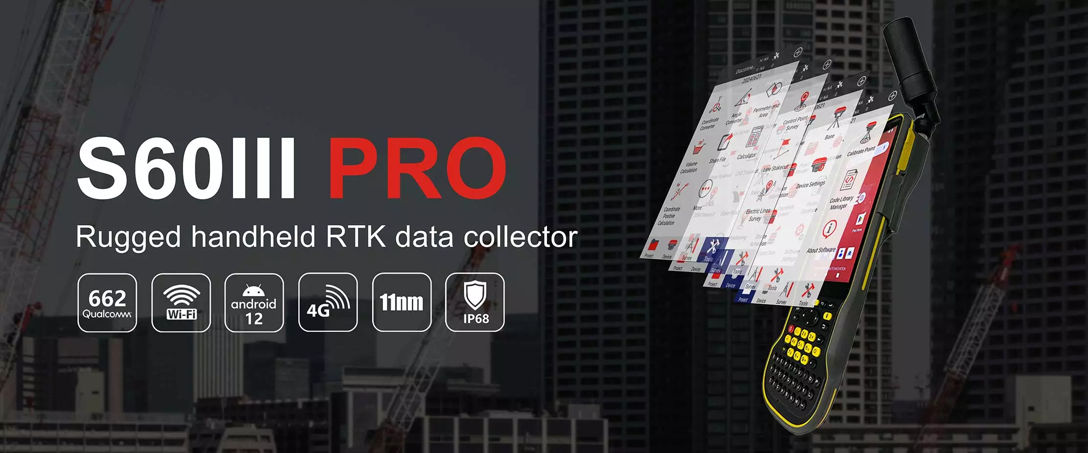
Handheld RTK data collector S60III PRO collection terminal
The S60III pro RTK handheld terminal is the ultimate solution for enhancing efficiency and productivity in mobile field operations. With centimeter to decimeter-level positioning accuracy, it is an extremely portable, durable, and versatile device, ideal for precision GIS data collection, power line inspections, construction site development, environmental research, landscaping, and various other applications. Equipped with a 5.5-inch sunlight-readable display, users can easily view GIS data tables, complex vector and raster maps, and high-resolution images even in bright sunlight and high-light conditions. Its industrial design, compliant with the IP68 standard, ensures reliable performance in extreme and challenging environments, making it the preferred choice for field professionals, particularly those with demanding equipment requirements.The S60III pro integrates precision GNSS positioning technology and long-range RFID technology, empowering efficient data collection for both individual operators and large field teams.
Data Controller
Handheld RTK data collector S60III PRO collection terminal
Rugged RTK data collector S60III for field measurements and mapping operations
S60III is a brand-new data collector featuring the latest industrial-grade processor from Qualcomm. With its slim form factor and a standard English keyboard, it's specifically designed for field measurements and mapping operations.  The 5.5-inch 500nit display utilizes Gorila Glass, enhancing durability while ofering exceptional sunlight readability. S60III provides various connectivity options, including Bluetooth 5.0, dual-band 2.4G and 5G W-Fi, and a 4G modem supporting global networks, ensuring seamless and reliable connectivity with your preferred GNSS receivers and RTK network correclion sources. The built-in 9000mAh battery provides long-lasting performance. Designed for extreme durability, it can with stand drops from heights of up to 1.5 meters and complies with stringent lP68 standards S60III excels in challenging environments, making data collection tasks easier and more efficient.
Data Controller
Rugged RTK data collector S60III for field measurements and mapping operations
High speed high power radio Harxon HX-U202 for GNSS/RTK surveying and precise positioning
HX-DU8602T is a high speed, high power, wireless data link built to survive the rigors of GNSS/RTK surveying and precise positioning. This radio’s 25W of power maximize range, enabling you to work in difficult urban areas. The HX-DU8602T is equipped with digital tube, LED and keypad, used to indicate the current operating status, as well as for changing the operating channel and power level of the radio modem. For the most rugged and reliable long-range data link, go with the Geomatics industry’s new standard in wireless communications HX-DU8602T.
Radios
High speed high power radio Harxon HX-U202 for GNSS/RTK surveying and precise positioning
High speed radio Harxon HX-DU8616D for GNSS/RTK surveying and precise positioning
HX-DU8616D is an advanced, high speed, high power, wireless data link built to withstand the demanding conditions of GNSS/RTK surveying and precise positioning. Due to the 35W high transmitting power, connection distances up to 20 kilometers can be covered in favorable conditions. It is designed with a ruggedized IP67 weatherproof enclosure to withstand extreme environments.
Radios
High speed radio Harxon HX-DU8616D for GNSS/RTK surveying and precise positioning

Have a question
before your project?

Dear, Fill in the contact form, and I will reply in 12 hours. All your messages are protected!

Please enter your name not exceed 100 characters
The email format is not correct or exceed 100 characters, Please reenter!
Please enter a valid phone number!
Please enter your content not exceed 3000 characters

FAQ

Contact customer service

Contact Us

Are you looking for a reliable and experienced partner to meet your needs? Join us.

×
Please enter your name not exceed 100 characters
The email format is not correct or exceed 100 characters, Please reenter!
Please enter a valid phone number!
Please enter your content not exceed 3000 characters